|
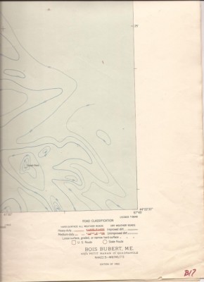
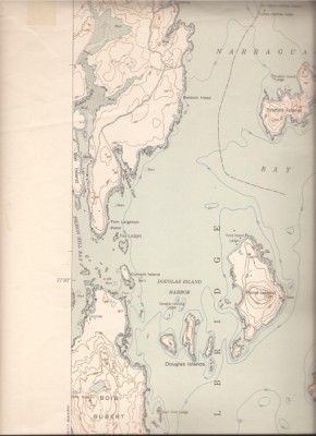
You are bidding on a 1950 Bois Burbert, ME United States Department of Interior Geological Survey 7.5 minute topographic map. It is 21" W x27 H, scale 1:24000, Contour Interval 20 feet Covers N4500-W6700/7.5.
Milbridge, Bois Bubert Island, Dyer bIsland, Pond Island...NOTE: All of my topo maps are folded in quarters.. They will be mailed flat. .. Some may have a small 1/4 circle for a project point. (I will note this) No project point on this one. Only writing way in lower right hand corner small B17.. Not on map itself in white area.
These are being sold cheap because they are folded. They still are very usable. I will combine shipping if you order more than one. If you need a scan or have a question please e-mail me..
|