|
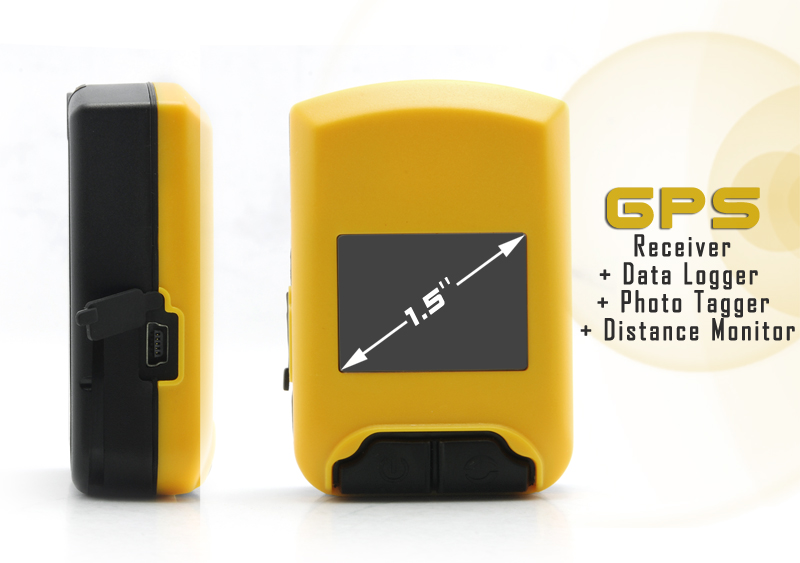
GPS Receiver + Data Logger + Photo Tagger + Distance Monitor
|
  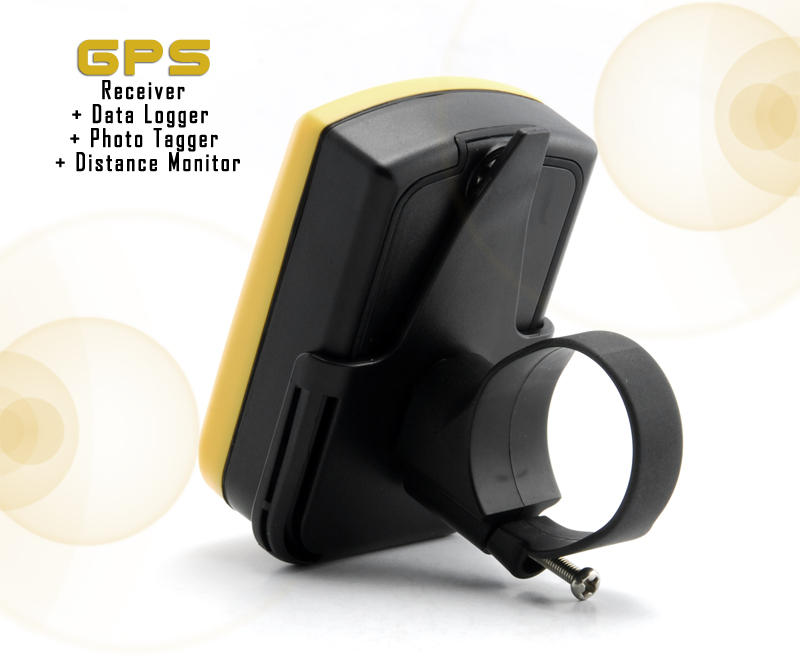        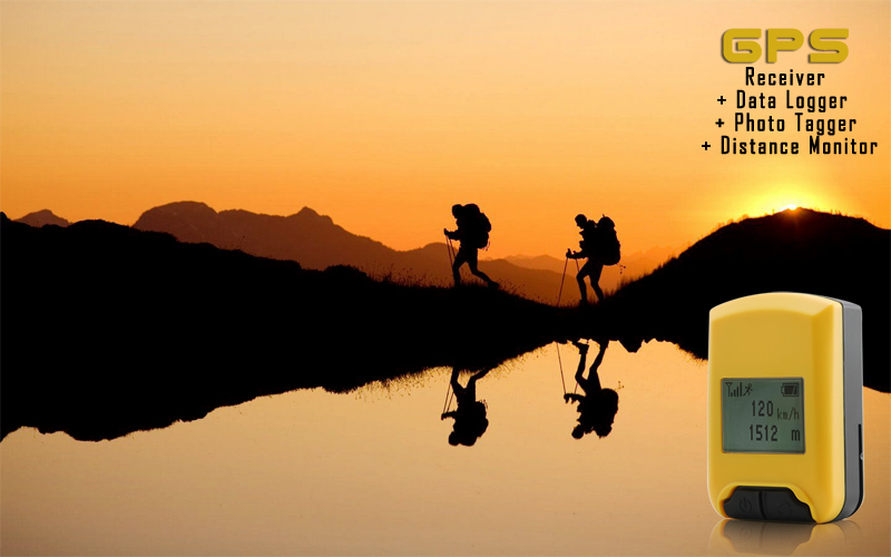

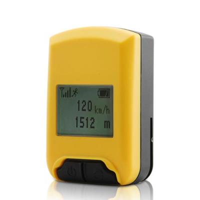
At a Glance... - All-in-one GPS Receiver + Data Logger + Photo Tagger + Distance Monitor
- 1.5 inch display
- 750 mAh Built-in Rechargeable Li-ion Battery
- Real-time longitude, latitude, altitude, and speed (velocity) data display
- Share your geo-tagged photos with family and friends on Flickr
- View your data paths on Google Maps or Google Earth
- Can even turn your laptop, notebook, or netbook into a GPS Navigator
- Waterproof
Manufacturer Specifications - Product Description: Mini Global GPS 5-in-1 Device (GPS Receiver + Data Logger + Photo Tagger + Distance Monitor)
- Display: 1.5 inch backlit screen
- Display Data: Longitude, Latitude, Speed, Altitude, UTC
- Waterproof: Yes, IPX-6
- GPS Chipset: Skytraq V621
- GPS Sensitivity: -159 dBM
- GPS Accuracy: 2.5 meters CEP (non DGPS)
- GPS Frequency: L1.1575.42 MHz
- Channels: 51 Channel Acquisitions / 14 Channel Tracking
- Protocol: NMEA 0183 v3.01 (GPGGA, GPGSA, GPGSV, GPRMC, GPVTG)
- Dynamics: 515 m/s, 4G
- Data Points Storage Capacity: 125,000
- Antenna: Built-in Patch Antenna
- Altitude Limit: up to 18,000 meters (60,000 feet)
- Velocity Limit: 515 meters/second (1000 knots) max
- Acceleration Limit: Up to 4 G
- Software Specifications
- View waypoints on Google Maps and Google Earth
- Upload photos to Flickr or Locr
- View multiple paths
- Display Speed and Altitude graphed against Time
- View speed, altitude, and GPS coordinates at any path point
- Add text, photos, audio, and videos to any path point
- Bulk shift photo date and time
- Edit tracks with ease
- Display distance in metric or imperial units
- Display GPS coordinates in degrees, minutes, seconds
- Log by time or distance intervals
- Show log with map
- Export path data as .KML, .NMEA, .GPX, or .CSV files to share your trips with your family and friends
-
Supported Languages: English, Chinese (Simplified and Traditional),
Thai, Czech, French, German, Italian, Japanese, Portuguese, Russian,
Spanish - Working Temperature: -20 to 60 C
- Humidity: up to 95% non-condensing
- Weight: 65g
- OS Compatibility: Windows XP, Vista, Windows7
- PC Interface: USB 2.0
- Built-in Rechargeable Li-ion Battery
- Battery Life: standby – 18 hours, working – 12 hours
- Dimensions: 71 mm x 47 mm x 25 mm (L x W x H)
- Certifications: CE, FCC, BQB, ISO 9001, ROHS
Product Notes - The
deluxe GPS device can also be used as a GPS receiver for your PC.
Simply attach it to your computer with the included USB cable and run
the included software.
- Comes with a display screen so you visual proof that your waypoints are saving correctly
- Compact, easy to carry, and comes with a FREE bicycle mounting cradle to attach it to your handlebar
- Can record GPS information on demand or periodically within a time frame
- Thanks to its durable and waterproof design, this is the best companion for real men (and women) who enjoy the outdoor life
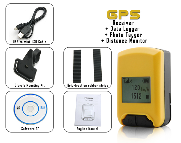
Package Contents - Waterproof Mini Global GPS Data Logger
- CD with windows drivers and software
- Bicycle mounting kit
- Manual (English)
- USB to mini-USB cable
- Slip free rubber strips x2
FAQ - Frequently Asked Questions - Why would I buy this Mini Global GPS 5-in-1 Device over others one I've seen?
Of all the many features this GPS gadget has, two come to mind as
outstanding. The first is, the LCD display. Instant visual communication
of important information like your exact point on Earth. Also, if
you've ever used a GPS device without a display, the thought of saving
thousands of waypoints while you're traveling with no visual proof that
it's being saved is an anxiety-filled experience. With this, you
log a data point. You have immediate visual confirmation that it's done.- How do I make sense of the longitude and latitude data this unit provides?
- Both Google Maps and Google Earth can easily translate the data into usable visual information.
- The
software sounds like it can do a lot: show your recorded paths, add
pictures, and upload geo-tagged pictures to Flickr. How can it do all
that? And is it hard to use?
The included software is extremely
user-friendly and easy to use. Every one of its great functions requires
just one click of your mouse. Plus, it's free! And if you find yourself
really getting into geo-tagging photos, you can find many outdoor
recreation forums and hobby groups on Facebook that can recommend even
more powerful commercial software to do even more powerful things with
your recorded GPS data.
|
|
|
|
 |
 Shopping Cart