|
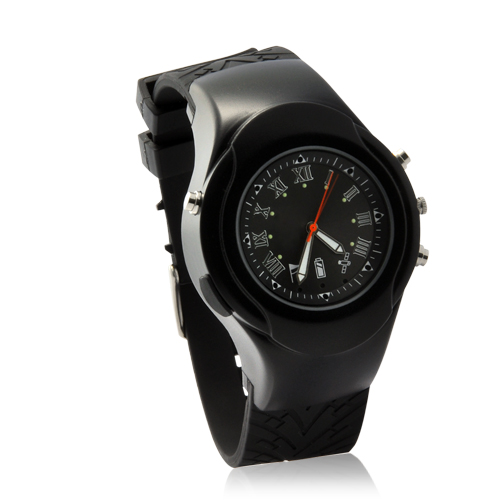
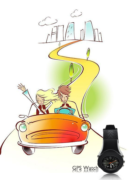
GPS Watch Deluxe (Location Finder + Data Logger + Photo Tagger)
|
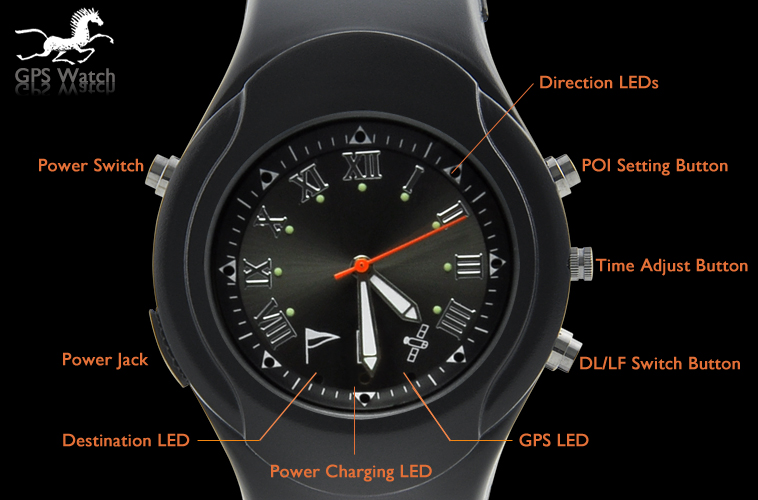
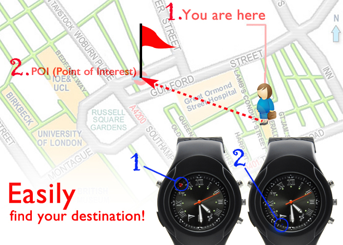

Locate places at just the touch of a button: With
multiple directional LED's, this watch will intelligently direct you
back to a previously logged (POI) point of interest (like where you
parked your car or your hotel). When you come within 50 meters of the
saved location, the arrows around the watch face will begin flashing,
and when you are within 15 meters the arrows will turn blue, letting you
easily and conveniently find your destination!
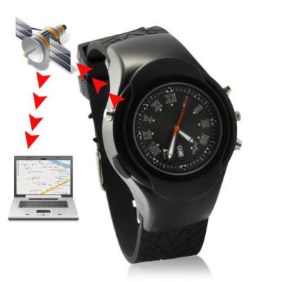
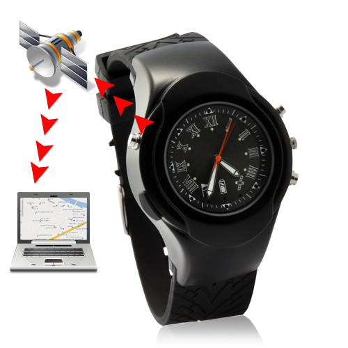
Record GPS data of your trip:
With the built-in data logger, this GPS watch will constantly record
your position, speed, and altitude, so when you get home, connect the
GPS watch to your computer and use the included iTravel Data Logger
software package to view all your logged paths right on Google Maps or
Google Earth. This powerful, easy-to-use function lets you relive every
point along your trip, as well as share with others!
Photo tagger:
Use the included Photo Tagger software to show locations where you have
taken photos and share your memories with others. Now your family and
friends all over the world can see your pictures and the exact location
where you took them!
At a Glance...
Software Functions - View in Google Maps or Google Earth
- Upload photos to Flickr and Flickr Maps.
- View multiple paths simultaneously.
- Adjust color and width of tracks.
- Display speed and altitude graphed against time.
- View speed, altitude, and GPS coordinates at any point on your path.
- Add photos, videos, audio files, comments, and place names to any point on your track.
- Write GPS info into photos.
- View slide show of your photos.
- Shift photo date and time
- Easy track editing.
- Display distance in metric or imperial units.
- Display GPS coordinates in Degrees or Degrees, Minutes, Seconds
- Detects GPS devices quickly and automatically
- Configure
GPS device to log by intervals of time (every 5 sec., every 10 sec.,
etc.), distance (every 5 meters, 10 meters, etc.) or speed (over 8
km/hr, over 25 km/hr, etc.). Can be configured to log when one condition
is met (e.g. create a log every 3 seconds) or only when multiple
conditions are met (e.g. create a log every 10 meters when speed is
greater than 60 km/hr).
- Export your paths as .KML, .NMEA, .GPX, or .CSV files to share your trips with your family and friends.
- No fees/subscriptions: Included software is free and requires no subscription for any of the above functions.
- Languages:
English, Spanish, French, German, Dutch, Italian, Portuguese, Russian,
Thai, Czech, Japanese, Simplified Chinese, Traditional Chinese.
- Compatibility: Windows 2000, XP, Vista, 7 (32 bit versions only)
Product Notes - GPS data logger and photo tagger functions require only this device and the free included software: no subscriptions, no fees!
- Accurate within up 15 meters
- Low power consumption
- Quick reacquisition of satellites
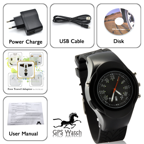
Package Contents - GPS Watch Deluxe- Location Finder, Data Logger, Photo Tagger, Receiver
- CD with Software
- User Manual - English
- USB Cable
- Power Adapter (100-240V 50/60hz)
- Free Travel Adapter (for UK, AU, NA, SA customers)
FAQ - Frequently Asked Questions - The
software sounds like it can do a lot: show your recorded paths, add
pictures, and upload Geo-tagged pictures to Flickr. How can it do all
that? And is it hard to use?
The included software is extremely
user-friendly and easy to use. Every one of its great functions requires
just one click of your mouse. Plus, it's free!
|
|
|
|
 |
 Shopping Cart